1. Maps – content and scales

Mapy.cz has a large database of basic elements that can be displayed. From this database, which contains several hundreds of elements, there was a need to choose and set a suitable rate of generalisation of the content of new maps. The main used method is generalisation of fusion of similar elements. This method allows to display content of maps in legible and synoptical form for tactile perception. Maps become difficult to be read by touch when more elements are used.

At the moment tactile maps are offered in 3 scales:

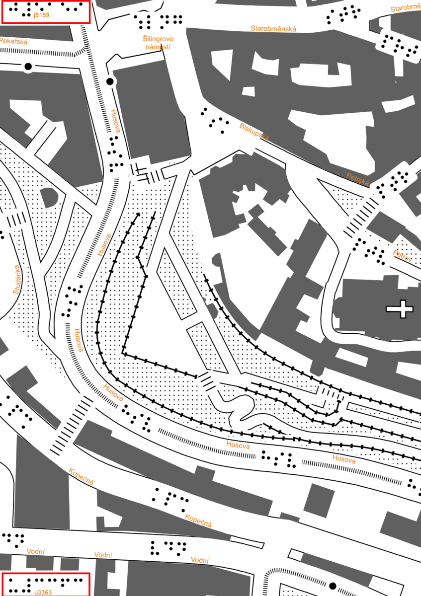
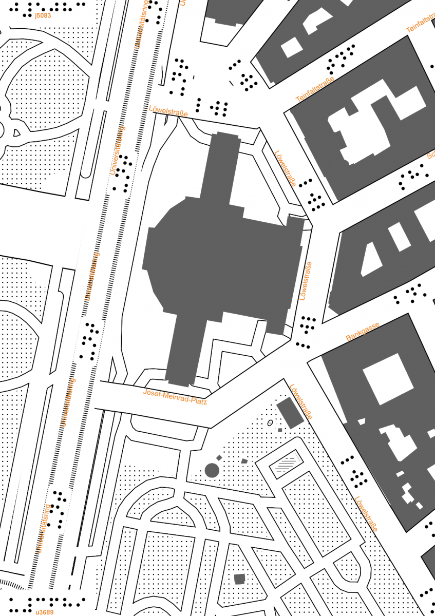
  • large 1 : 1 200 (depiction of streets); tactile maps of this scale can be called “default”
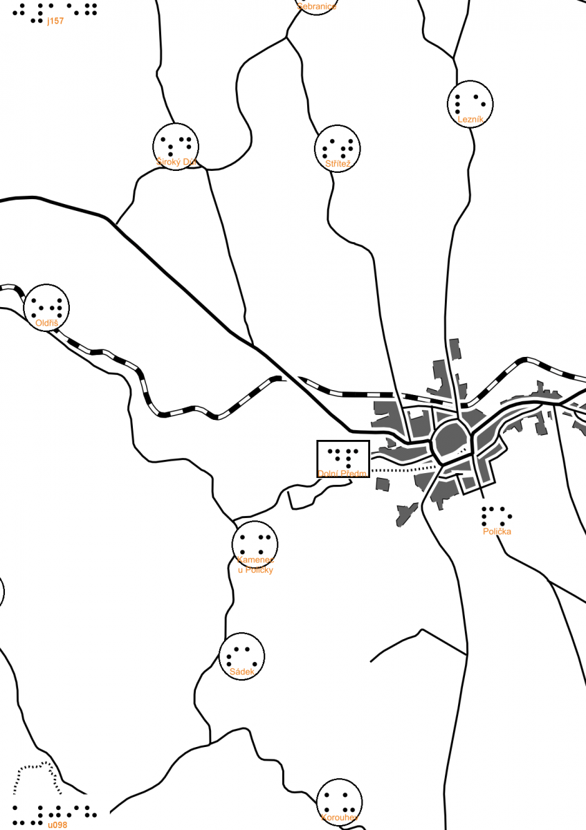
  • medium 1 : 37 000 (depiction of urban areas)
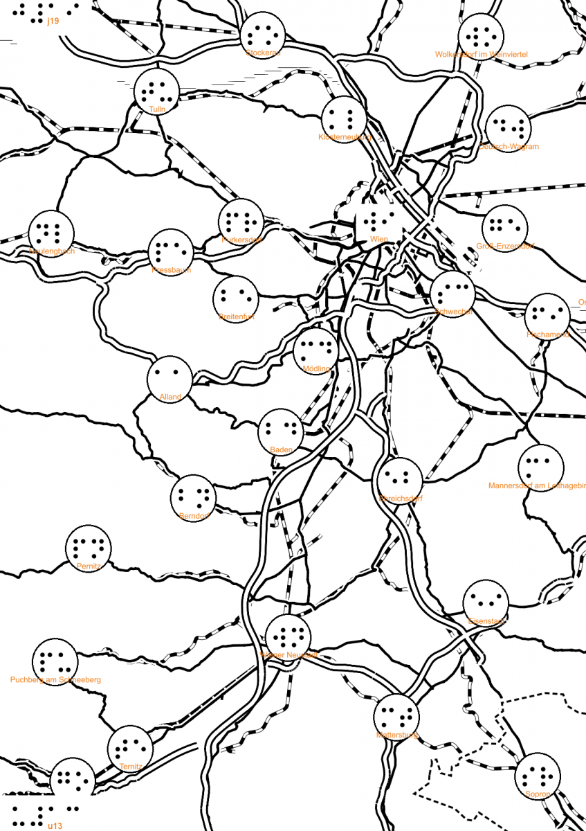
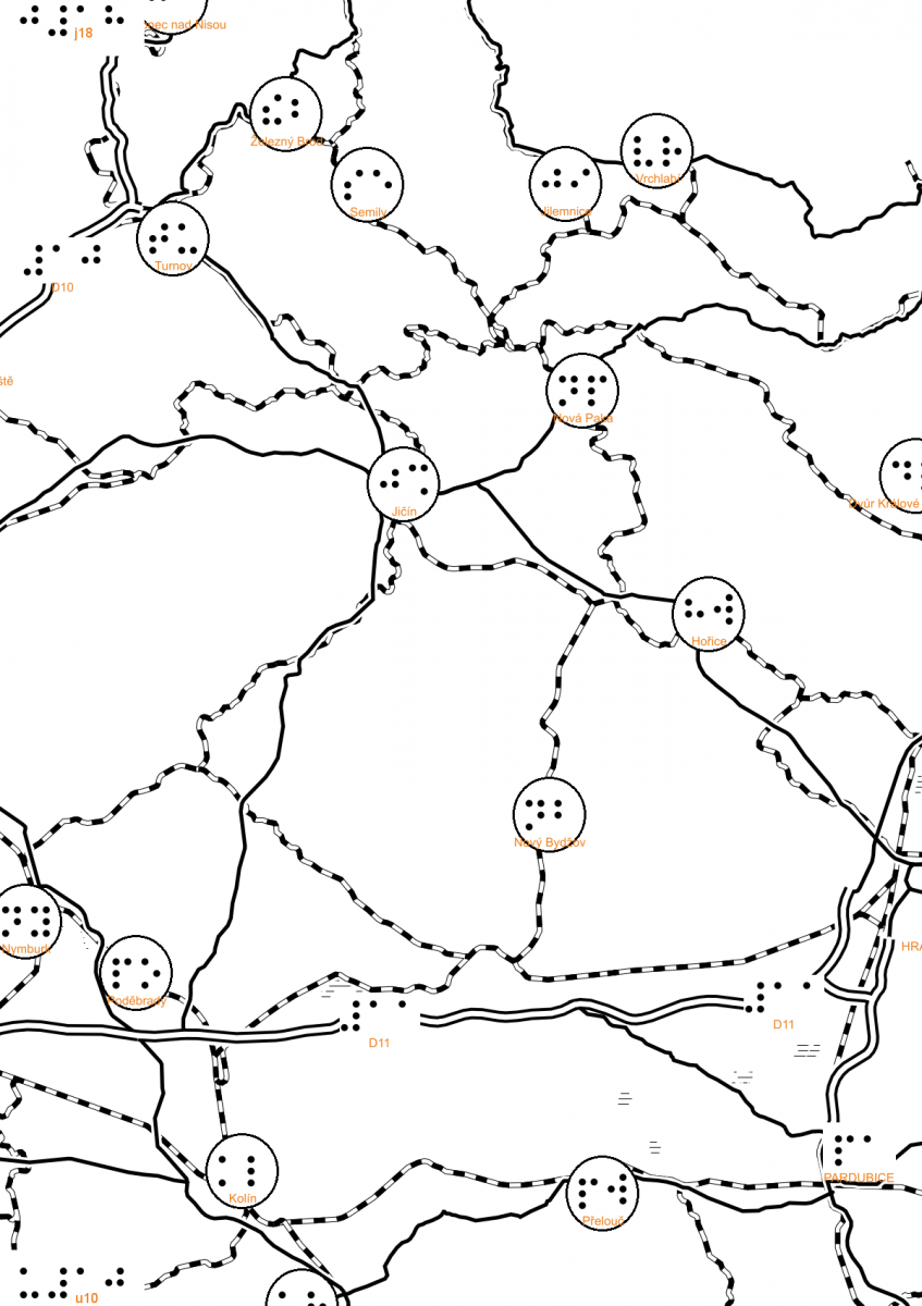
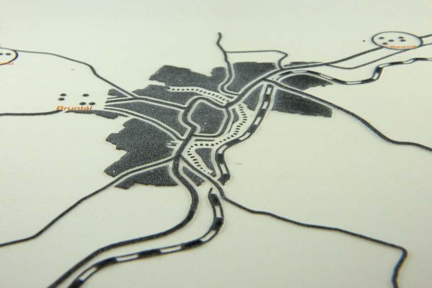
  • small 1 : 300 000 (depiction of large cities)

Numerical values of the scales are valid for the area of the Czech Republic (generally for geographical latitude 50°). With the extension of the maps on the whole world and with respect to used cartographical projection (transverse cylindrical Mercator) it is needs to be taken into account that the map scale changes with the change of latitude (is enlarging from the equator to the poles – see the table).

latitude large scale medium scale small scale
1 : 1 800 1 : 57 000 1 : 460 000
10° 1 : 1 800 1 : 57 000 1 : 460 000
20° 1 : 1 700 1 : 54 000 1 : 430 000
30° 1 : 1 500 1 : 50 000 1 : 400 000
40° 1 : 1 400 1 : 44 000 1 : 360 000
50° 1 : 1 200 1 : 37 000 1 : 300 000
60° 1 : 900 1 : 29 000 1 : 230 000
70° 1 : 610 1 : 20 000 1 : 160 000
80° 1 : 320 1 : 10 000 1 : 82 000

To allow the cooperation between a blind and a sighted user the map description is accomplished in two ways. Primarily, streets are marked in the default map by abbreviations of three letters based on the name of the street. The letters are written in Braille alphabet in the axis of the street. Abbreviation of four letters are used to label squares. The abbreviations are generated in a way that repetition is avoided on the displayed area. These letters are supplemented by full names of the streets written in orange colour that is not affected by heat treatment, so it remains noticeable only visually. Names of settlements are analogically labelled in maps of smaller scales – the labels consist of abbreviations of two letters from Braille alphabet and full names in orange colour.

Maps of different scales

2. Displaying the map on map sheets

In contrast to usual maps available on the internet tactile maps are displayed on individual predefined sheets. The reason is that maps are presented in printed (tactile) form. The area displayed on individual A4 sheets is 235 x 330 m in approximate scale 1:1200. This scale is the best to display urban environment with a focus on street network. This depiction corresponds to no. 19 approximation on Mapy.cz. Map sheets in smaller scales are again A4 and they depict the area 7.5 x 10.5 km in scale 1 : 37000, in scale 1 : 300000 the depicted area is 60 x 85 km. The area of your choice can be of course displayed on multiple sheets, in that case practicality of such a map (and its financial costs) must be considered.

Map (set of map sheets) is selected in a similar way to a usual map, that is – setting the settlement, street (it is displayed from the centre of the street), direct input of coordinates of any point, or direct input of pressmark of the map sheet (see below). After selecting the map the user is offered the basic map list and a grid where the range of map sheets can be chosen at the user’s will. The grid of map sheets changes according to approximation to correspondent map scale. Individual map sheets are tied together so that larger maps can be created. In the next step the user downloads archive with individual sheets (graphic PNG file) and the list of used abbreviation and further additional information (TXT file). The map legend, unified for the correspondent scale, can be attached to the map as a PNG file.

Examples of working with map sheets

3. Map sheets identification

Individual sheets are marked within a unified system with column identifiers (e.g., j4481), that are placed on the top of the sheet, and row identifiers (e.g., u3065), that are placed at the bottom of the sheet. When generating a map, the user can choose to place these identifiers either to the left, right, or centre (depending on how the sheet identification affects the map drawing). If the map sheets are about to be firmly connected into a larger map it is possible not to print the marks at all. For easier readability the identifiers (as well as street names) are printed both in Braille and Latin alphabet (colour is used).

Identifiers of maps with smaller scales are organised in the same way, main difference being the number of digits in the identifier. Maps in scale 1 : 37 000 have 3 digits (e.g. j144_u097), maps in scale 1 : 300 000 two digits (e.g. j18_u11).

Map sheets layout (division into individual sections) can be seen in the image below.

Map sheets identification and layout

4. Printing the map

As far as the hard copy of the print sheet is concerned, the use of microcapsule paper is a quite fast method of shaping the relief. The first stage is the traditional print, this way the content of the map is printed on a special paper. Black elements become embossed after finalising in a special device with an infra-red lamp. Currently there are two devices available on the Czech market: Zy Fuse Heater by British company Zychem (this device is often called “fuser” in the Czech Republic) and a device called P.I.A.F by a Polish producer HARPO.

When printing and finalising relief picture it is necessary to check the result relief to see whether all parts of the print area reacted to the heat treatment. It is especially important to check characters of Braille alphabet and weaker structures of individual raster. For a better result it is recommended to heat up the device by repeatedly pulling a sheet of heavy white paper through the device before printing the map sheet itself. It also helps to pull the printed microcapsule paper through the device twice.

Printed maps